Conquering Castle Hill: Walking Tracks Beyond the Goat Track

Published
Last updated
Castle Hill, at an elevation of 286 metres, is the most popular fitness place to be within Townsville City. There are many walking tracks to take to the top and it is a great way to get fit and be active. From the road to the more intensive goat tracks and hell's staircase, there's a route for everyone and any fitness level. Castle Hill is most busy around 5-7 am and 5-7 pm on weekdays as it tends to be the choice for pre- and post-work workouts. During quieter times, the tracks are a good option to practise trail running. Castle Hill is even dog-friendly with many people choose to take their dogs on a leash via the road.
Hike Overview
Location: Townsville, North Queensland, Australia
Distance: 700 metres to 1.1 kilometres one-way depending on track taken
Duration: 30 minutes to 1 hour depending on track taken
Grade: 3, easy
Elevation: 286 metres above sea level
Best time: Early morning (5-7 AM) or late afternoon (5-7 PM) for cooler temperatures
About Castle Hill
Castle Hill has formerly also been known locally as Cutheringa, Cudtheringa, Cootharinga, and Mt Cutheringa. The Aboriginal history associated with Cutheringa has not been recorded, but its name survives as one of only two known Australian Indigenous place names in the Townsville region, the other being Pallarenda. Its Indigenous name is actually Cootharinga, sometimes written as Cooderinga.
The Traditional Owners of Townsville are the Wulgurukaba of Garumbilbarra and called Castle Hill 'Cutheringa'. Cutheringa is of deep spiritual significance to its Traditional Owners and features prominently in their Dreamtime stories.
Most of the area is taken up with the Castle Hill Reserve with only a small part in the northeast of the area being available for housing. It's a suburb of Townsville that dominates the city skyline. The other iconic centrepiece for the city is a skyscraper known as the "Sugar Shaker".
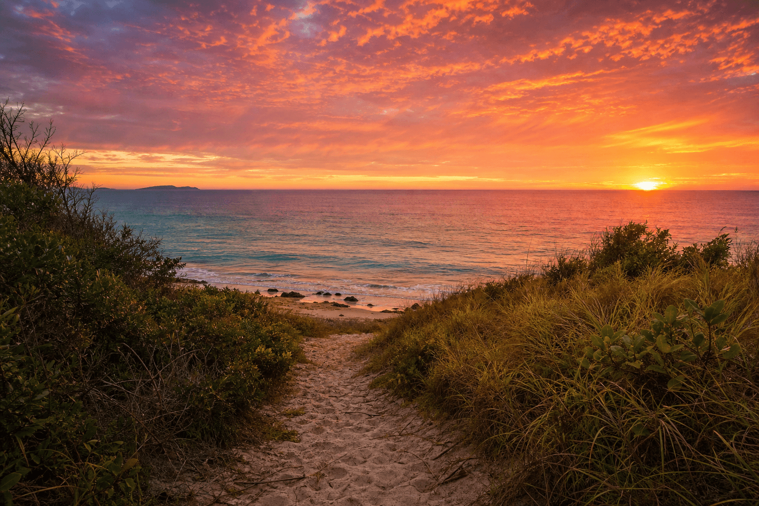
As well as offering vehicle access to the summit, Castle Hill provides a number of popular walking tracks frequented by many locals! The 360-degree views of Townsville at the top are well worth the journey, particularly for sunrise or sunset; even the view of the city lights is quite spectacular.
Official Trails
There are in fact 8 council-recognised trails and 15 walkable trails to its summit. All the tracks are well-worn and easily followed. Please note that shortcutting causes erosion.
Cudtheringa Track
Distance: 1.1 km one-way
Duration: 30 min
Grade: 3
The most popular Castle Hill walking trail, the Cudtheringa Track 1.1 km one-way, medium difficulty. It is accessed from opposite the bottom car park near the base of Castle Hill Road and leads walkers out back onto Castle Hill Road near the top just below the summit car park. On leaving Castle Hill Road, the route climbs steeply through scrubby vegetation and rocky landscape, heading up the north-western flank, then meets with The Goat Track, before climbing steeply. The middle section of the track is generally flat while the start and end have a steeper incline. Along the trail, you will have views up to the craggy bluffs and out to the city and Magnetic Island. The Cudtheringa Track is the popular choice for pre- and post-work workouts.
Ironbark Track
Distance: 700 m one-way
Duration: 30 min
Grade: 3
This 700 metre one-way track is a pretty but challenging trail. It's not as populated as the city-side tracks, like the Cudtheringa Track. The track starts at James Street, West End or via the gate at Green Street. The track spits you out three-quarters of the way up Castle Hill Road from where you can continue up the road, or take the "Scramble Track" the rest of the way.
The Ironbark Track starts steeply and is loose, rocky and maybe slippery descending, but it's great for cardio. There's a bench at the top of the trail for a rest before continuing. This route will get your calf and heart muscles working a little harder as it is a steep climb for most of the way. The surface is loose, rocky and eroded in places and is not recommended in wet weather. But it has the advantage of fewer people than the city-side tracks.
Triandra Track
Distance: 870 m one-way
Duration: 15-20 min
Grade: 3
The Triandra trail branches off from the Ironbark track and links Stagpole Street, (north) West End to the Dianella Track and Maidenhair Track near the cemetery, (east) West End. This flat trail traverses the base of the hill and has views inland to Mount Stuart. There is a brief break in the track at the disused quarry but the track continues across and up the other side. The most challenging part of the track is on the West End Cemetery side where you need to do a little scramble. After heavy rain, the sides of the quarry become a waterfall.
Dianella Track
Distance: 840 m one-way
Duration: 30 min
Grade: 3
Considered one of the most challenging of Castle Hill's offerings, this track starts at the end of Church Street in West End, behind the West End Cemetery, takes you near the summit's lower car park, just a bit downhill from the Cutheringa Track. It is largely straight up and crosses patches of exposed, slabby rock then begins a continuous climb along a rocky track to the summit. The track is 840 metres one-way heads almost straight up the very steep slope.
After scrambling up the first rocky outcrop near the base of Castle Hill, look back at the spectacular views from Frederick Peak across to Cleveland Bay. The top of this rock flattens out nicely where it's possible to enjoy a picnic and the ambience. The track then takes you straight up the rocky climb to the top. This track is steep and can be slippery if descending, especially in the rain.
Blue Spot Track (White Arrow Track)
Distance: 850 m one-way
Duration: 30 min
Grade: 3
The Blue Spot Track, also called the White Arrow Track, was given its name by the local walkers (Ian Wallace & co) and is a bit tricky to find the entrance when it's overgrown. This track starts on the Maidenhair Track, just a bit further east of where the Dianella Track joins the Maidenhair Track. Look for the gully with a small, rusty, metal footbridge and the white arrows painted on the rocks on the western side. The Blue Spot Track joins into the Dianella Track near the top where you have the option to easily access Castle Hill Road or head down Dianella Track.
It's best accessed via Skully Street but there's limited car parking here. This trail surpasses the Dianella Track in both technical and endurance difficulty, as it's steep with large granite slabs to clamber over. Apart from the concealed start, the Blue Spot Track is well-worn and clearly marked with white painted arrows, so there's little chance of becoming lost.
Maidenhair Track
Distance: 1.3 km one-way
Duration: 20-30 min
Grade: 3
The Maidenhair Track is flat and easy and traverses the base of Castle Hill from West End Cemetery, Church Street to the Goat Track in town. There are some nice pretty sections, including a small footbridge over an intermittent stream that only flows after heavy rain. Although the elevation isn't high, the view out to Mount Stuart is surprisingly impressive for the little effort.
Goat Track
Distance: 1.1 km one-way
Duration: 30 min
Grade: 3
This track has excellent vistas over the city, Magnetic Island, South Townsville, the tip of Pallarenda and around to Cleveland Bay from the lookout. It can be crowded after work and on weekends. It's possible that the name comes from the wild goats that lived on the hill pre-1890s. The well-named Goat Track has an approximate elevation gain of 180 metres.
Starting at either Hillside Crescent, Jones Street, or the newly constructed stairs at the end of Walker Street. The best way to describe the Goat Track is short, steep, and well-worn path up the eastern flank to the summit. This 1050 metre one-way trail starts with a steep climb up the road and offers some brief respite once you get to the track. At the Cudtheringa Track and Goat Track intersection, there is a lookout just before the main staircase.
Widow-maker Track
Distance: 220 m one-way
Duration: 10-15 min
Grade: 3
Nicknamed the Widowmaker by locals (Ian Wallace & co), the aptly named track provides spectacular views over granite slabs. Just don't lose your footing in some parts as there are no safety barriers. The un-signposted track branches off from the Goat Track and Cudtheringa Track Junction, about three metres past the top of the concrete stairs. This trail provides the best views of all the trails. The track eventually spits you out at the end of the Summit Walk at the easternmost lookout - a great place to catch your breath.
Erythrina Track
Distance: 440 m one-way
Duration: 15-20 min
Grade: 3
Erythrina Track is a 'shortcut track' that allows you to cut a corner of road off. The Erythrina Track is short, easy, and convenient. Many walkers know it exists, but many don't realise that it actually starts from Balmoral Place next to Yarrawonga Drive.
The Ladies' Track (Erythrina to Scramble Track Link)
Distance: 1.3 km one-way
Duration: 15-25 min
Grade: 3
The Ladies' Track is the inconspicuous route that 'female friends' took to visit the soldiers manning the Pillar Boxes on the top of Castle Hill in WWII. This trail has recently been recut. The track starts on the western side of Castle Hill at the Erythrina Track near the water tank. It then ascends the ridge to the base of the Scramble Track, the tracks off left and traverses below the cliff line and Jenkinson's Post Lookout, and continues across to join the Pillar Box Walk. You can make out some rock steps in places. The track is relatively easy with no steep climbs and is a great way to add variety to your walk.
West Ridge Track
Distance: 1 km one-way
Duration: 30 min
Grade: 3
This one-kilometre trail starts on William Street, West End and finishes halfway up the hill, just opposite the end of the Erythrina Track. The start is rocky and relatively steep and then it flattens out onto the ridgeline where there are views of The Strand and Magnetic Island to Mount Stuart.
Belgian Gardens Link Track
Distance: 1.2 km
Duration: 15-20 min
Grade: 3
This easy track connects Belgian Gardens with the Erythrina Track and is fairly flat with some minor inclines. It starts near Belgian Gardens State School on Potts Street and can be followed around the back of the schoolyard and up to the water reservoir.
West End Link Track
Distance: 550 m one-way
Duration: 10 min
Grade: 4
This track starts on William Street (near the West Ridge Track). Follow the rough trail steeply up past some rocky slabs. The track then contours around the hill and then you'll find yourself at the top of a large granite slab overlooking the Belgian Gardens State School. This track required a good level of navigational skills and fitness.
The Scramble Track
Distance: 330 m one-way
Duration: 5-10 min
Grade: 4, loose and steep
The Scramble Track, also known as the "Suicide Track" or "Heartbreak Track", is a well-worn, eroded, and unmarked trail that takes you from Castle Hill Road to around the back of the summit to join the Radar Hill short walk. This trail is very steep, loose, and challenging due to the unstable terrain.
Westies Track (Donkey Track)
Distance: 660 m one-way
Duration: 10-15 min
Grade: 3
The Westies Track is also known as the Donkey Track and is one of the harder trails to see, especially during and after the wet season. This unmaintained trail starts on Castle Hill Road a couple of hundred metres after the bottom car park and eventually links to the Scramble Track, opposite the Ironbark Track. It was built as an unsanctioned pirate mountain bike track and downhill mountain bikers do occasionally ride it so be mindful.
Jacobs Ladder
Distance: 140 m one-way
Duration: 3-5 min
Grade: 2
Jacobs Ladder is also a popular place to start your journey up Castle Hill. It features a long flight of stairs that steeply rise through the suburbs to the base of Castle Hill. It's a great cardio workout that will definitely get your heart beating.
Lookout Pathways
The main lookout is Jenkinson's Post Lookout but there are also a couple of short, well-maintained, concreted paths you can do when you've reached the top of Castle Hill (either by car, walking/hiking/running, or climbing). These paths are particularly great for visitors and tourists as they afford unrivalled views of Townsville and surrounds and have historical significance.
Summit Walk
Distance: 200 metres one-way
Duration: 5 min return
Grade: 2, some stairs
The Summit Walk is great for those wanting some breeze and 360-degree views. Some run the stairs a few times as an extra workout before they descend. The Summit Walk is also home to Hynes Lookout, which is one of the best and most popular lookouts.
Pillar Box Walk
Distance: 350 metres return
Duration: 2-5 min
Grade: 2, some stairs
The Pillar Box Walk takes you to two lookouts, both of which have views over the city and the Eastern Bluff cliff face, one of the lookouts also is home to a WWII Observation Post constructed in 1942.
Radar Hill Walk
Distance: 300 metres loop
Duration: 5 min
Grade: 2, some stairs
The Radar Hill Walk takes you around the backside of the towers and provides views out to Hervey Range. The best views are at sunset.
Popular Circuits and Loops
Cutheringa Loop
Distance: 4.2 kilometres
Time: allow 1-1.5 hours
Start by walking up the Cutheringa Track to Castle Hill Road. Enjoy the summit before easily walking down the road to your car.
Around the Base Route
Distance: 6.2 kilometres
Time: allow 2 hours
Start at the bottom of Cudtheringa Track on Castle Hill Road. Walk up the road to the Erythrina Track. Walk down the stairs on your right and immediately to your left following the pipeline. Once you reach to the water reservoir, take a left and walk along the Belgian Gardens Link Track. Walk for the pink tape and white star pickets on the left, as this marks the West End Link track. Go steeply uphill past a granite slab and down to William Street. Walk to the West Ridge Track and up along the track to the Triandra Track. Pass the quarry and join into the Maidenhair Track. Contour around the base to The Goat Track and follow that up the stairs to join into the Cudtheringa Track. Walk down the Cudtheringa Track track and back to Castle Hill Road where you started.
City Slicker Route
Distance: 3.2 kilometres
Time: allow 1 hour
Start by ascending the Goat Track to then traverse the Maidenhair Track. Climb up the Dianella Track or the Blue Spot Track onto Castle Hill Road. Walk down the Goat Track.
The Quad Master Route
Distance: 3.6 kilometres
Time: allow 1 hour
Start walking up the Dianella Track or Blue Spot Track to Castle Hill Road. Then walk down the road to descend the Ironbark Track. Finish the route off by traversing the Triandra Track.
West End Wonder Route
Distance: 4.6 kilometres
Time: allow 1.5 hours
Start at the Ironbark Track, cross the road and carefully clamber up the Scramble Track to the summit. Descend Castle Hill Road before making your way down the West Ridge Track.
The Many Trails Route
Distance: 5.9 kilometres
Time: allow 2 hours
Start along the Ironbark Track and traverse the Triandra Track and then the Maidenhair Track. Walk up the Goat Track to Castle Hill Road and then up the Radar Hill Path. Carefully descend the loose Scramble Track to the Erythrina Link Track and then onto Castle Hill Road and down the West Ridge Track.
Facilities
Castle Hill facilities include car parking, coach parking, public toilets, a drinking fountain and shaded seating to enjoy while taking in some of the best views of the city and across to Magnetic Island and Cleveland Bay.
Guidelines
It's quite fun to speed down the hill on a bicycle but watch your speed and do not exceed 40 km per hour, otherwise, risk a fine. Walkers and runners must walk no more than two people across - this allows safe space for all users, including cars and cyclists. Townsville also has many great walkways and bike paths throughout the city.
History
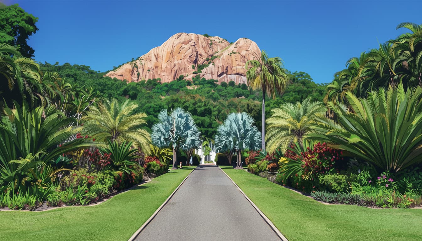
Successive intrusions of volcanic activity formed Castle Hill along with Magnetic Island, Cape Cleveland and Mount Elliot. These landforms resisted erosion leaving Castle Hill as an isolated, pink granite monolith. An inselberg is an isolated hill, knob, ridge, outcrop, or small mountain that rises abruptly from a surrounding plain.
Castle Hill is made of igneous granite rock which is formed when magma cools and solidifies within the Earth's crust and is the most common igneous rock type. Castle Hill is an inselberg of Carboniferous-Permian origins, rising abruptly from the younger Quaternary coastal plain.
Andrew Ball, Mark Watt Reid, and a small party of aboriginal people set out from Woodstock Station in April 1864 and were the first Europeans to explore the Cleveland Bay and Ross River areas in search of a suitable site for a port and boiling-down works under the instruction of John Melton Black. Andrew Ball named the monolith 'Castle Hill' apparently because it resembled a similar feature in the Isle of Man. The Townsville settlement was initially known as 'Castletown', until it was renamed Townsville in 1865 by Captain Robert Towns.
It wasn't until 1888 that it was gazetted as a recreation reserve with about 228 hectares. Just metres short of a mountain, Castle Hill is now a heritage-listed lone pink monolithic granite giant that overlooks the centre of Townsville.
The road to the summit was called Hynes Road or Hynes Highway, which is now called Castle Hill Road. Both Hynes Road and Hynes Lookout were named after the then Minister for Labour and Industry, Hon. MP Hynes and opened on 27 February 1937.
In 1941, the Captain Robert Towns obelisk-like monument was relocated and erected at the summit car park and commemorates the founder of Townsville. During World War II, the vantage points on Castle Hill were used by visiting American soldiers. A concrete bunker was constructed as a Command Post, to allow for surveillance of Cleveland Bay. The Observation Post bunker was constructed in 1942 and still stands today.
In 1962, eight James Cook University students painted a white stick figure, 'The Saint' from a 1960s British television series, on Castle Hill's northern face as a prank. In 2002, Townsville City Council reversed its decision to remove it only after a poll indicated 54% of the population considered it an icon! That poll cemented The Saint's place in Townsville's cultural landscape and it's still Townsville's most famous graffiti.
On 28 May 1993, Castle Hill was listed on the Queensland Heritage Register.
Wildlife and Nature
The rocky landform predominantly supports mixed eucalypt vegetation with a variable understorey. Grasses such as kangaroo grass and giant spear grass grow on the exposed, steeper slopes while hummock grasses grow on the cliff faces and rocky outcrops. Echidnas are commonly seen at dusk on the hill.
Castle Hill supports a diverse range of flora, with approximately 300 plant species identified, including unique orchids and grasses. Fauna observed on the hill includes over 50 bird species, such as peregrine falcons and brahminy kites, as well as echidnas and rock-wallabies.
Best Times to Visit
Early Morning (5:00-7:00 AM):
Perfect for exercise with cooler temperatures and beautiful sunrise views over the city. Most popular time for locals.
Late Afternoon (5:00-7:00 PM):
Ideal for post-work workouts and stunning sunset colours reflecting on the city and Magnetic Island. Second most popular time.
Daytime:
Great for visitors and tourists, with quieter trails and spectacular 360-degree views of Townsville and surrounds.
Sunset/Sunrise:
The 360-degree views are particularly spectacular at sunrise or sunset, and even the view of the city lights is quite spectacular.
Getting There
Location: Townsville City, North Queensland, Australia
Parking: Multiple car parks including bottom car park and summit car park
Public Transport: Accessible from Townsville city centre
Walking Distance: Multiple access points from surrounding suburbs
Local Tips
- Early Start: Arrive early (before 7 AM) to avoid crowds and heat
- Water: Bring plenty of water, especially for the steeper tracks
- Footwear: Wear sturdy shoes with good grip for the rocky terrain
- Dog-Friendly: Dogs are allowed on leash via the road
- Weather: Avoid tracks after heavy rain as they can be slippery
- Trail Running: Quieter times are great for trail running practice
- Sun Protection: Bring sun protection during the day
- Shortcutting: Please note that shortcutting causes erosion - stay on marked tracks
Pacing beyond "the Goat Track"
Locals talk about steep nicknames, but Castle Hill is a trail network-pick routes for heat, footwear, and knees, not café gossip. Confirm gradients and names on Castle Hill Lookout and Walking Tracks (Townsville City Council) before you head out.
For storytelling and photography from the hill, see Wanderstories - Castle Hill-still verify closures and signage locally.
WWII heritage and relics
Concrete pads, trenches, and lookout structures are heritage-not climbing gyms. Do not rely on crowd-sourced GPS pins for relics; precise pins invite vandalism, illegal shortcutting, and rescues from unstable edges. Use council interpretation and on-site signage, and stay on formed tracks.
Heat, hydration, and when to turn back
Humidity makes "easy" grades feel harder. Carry enough fluid for the descent; prefer early morning or late afternoon loops whenever possible. Dizziness, cramping, or tunnel vision means turn around and take the safest formed route down.
Etiquette
Yield on narrow tread, leash dogs unless signage clearly allows otherwise, and keep noise respectful near residences. Pick up stray rubbish; report damaged signage through council channels.
Bushwalking context
For organised trip culture and difficulty expectations in North Queensland, see The Townsville Bushwalking Club-even if Castle Hill stays your weekday solo circuit.
FAQ
Which track is easiest for newcomers?
Read the council track notes and start with shorter loops while you adapt to heat-avoid chasing steepest nicknames on day one.
Night walking?
Only with reliable lighting and snake awareness; casual night ascents are rarely worth the margin.
Are WWII areas for off-track exploring?
No-observe from formed tracks; do not move artefacts or cut new lines through heritage terrain.
Castle Hill stands as Townsville's most iconic natural landmark, offering locals and visitors alike multiple ways to experience its summit and spectacular views. With tracks ranging from easy road access to challenging goat tracks, there's truly a route for everyone and any fitness level. The combination of natural beauty, fitness opportunities, and rich history makes Castle Hill an essential Townsville experience.