Noosa National Park coastal walk: Noosa Heads to Sunshine Beach guide

Published
Last updated
The Noosa National Park coastal walk is one of those rare Queensland tracks that suits a wide range of walkers. You can keep it short with a lookout stroll, turn around at Hell's Gates for the classic outing, or continue to Sunshine Beach for the full return.
What makes the route so popular is that the scenery keeps changing. Instead of one big payoff at the end, you get repeated headland views, rocky bays, small beaches, and regular chances to spot marine life if conditions line up.
Quick route overview
- Distance: up to 10.8 km return from Noosa Headland day-use area to Sunshine Beach and back
- Time: about 1.5 to 2.5 hours to Hell's Gates return, or around 4 hours for the full walk
- Difficulty: moderate to hard (officially Grade 4 for the full route)
- Track type: sealed path early, then formed dirt, rock, stairs, and uneven coastal sections
What to expect on the track
From the Noosa Headland day-use area at the end of Park Road, the walk starts on an easy sealed path past Boiling Pot and toward Dolphin Point. This opening section is the most accessible part of the route and works well if you want strong views without committing to the full distance.
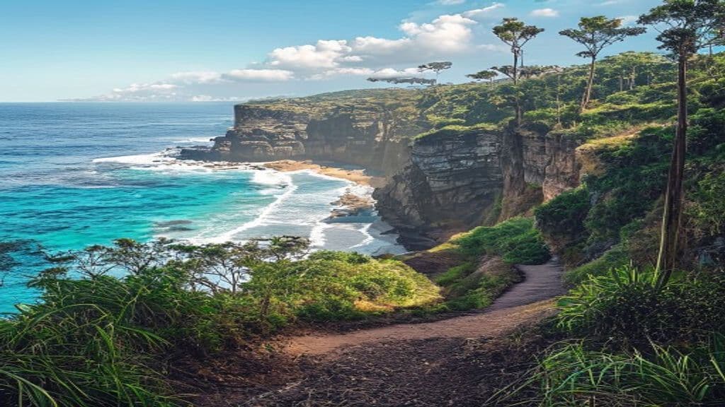
Beyond Dolphin Point, the track becomes more natural underfoot. You move through pockets of pandanus, tea tree, coastal heath, and open viewpoints above Tea Tree Bay, Granite Bay, and Alexandria Bay. It is not especially remote, but it feels more rugged once the paved surface ends.
Hell's Gates is the signature turnaround point for many walkers and a smart choice if you want the best scenery without doing the full 10.8 km return. On clear days, this headland often gives you the strongest big-ocean views on the route, and it is one of the better spots for whale watching in season.
If you continue to Sunshine Beach, expect a longer outing with more sun exposure and a return leg that feels noticeably tougher than the first half.
Highlights
- Big coastal views almost the entire way
- Easy short-walk options to Boiling Pot, Dolphin Point, or Tea Tree Bay
- Hell's Gates headland scenery with whitewater, cliffs, and wide ocean outlooks
- Good chance of spotting dolphins, turtles, and humpback whales in season
- A flexible route that works as a short scenic walk or a longer half-day hike
Safety and conditions
Check official updates before you go:
- QPWS Coastal Walk, Noosa National Park
- Noosa National Park walking tracks summary
- Noosa National Park headland map PDF
Key safety points:
- Start early if you want Park Road parking. It fills quickly on weekends, holidays, and school breaks.
- Carry water and sun protection. The sea breeze can hide how exposed you are.
- Keep back from cliff edges around headlands and viewpoints, especially near Hell's Gates.
- Tea Tree Bay, Granite Bay, and Alexandria Bay are scenic, but surf and rocks can make them poor swimming choices for many visitors.
- Stay on the marked track and do not feed wildlife, even if lace monitors or birds come close near the day-use area.
Practical tips for walkers
- If you want the classic version, walk out and back to Hell's Gates rather than rushing the full Sunshine Beach return.
- If you are short on time, Tea Tree Bay is an easy scenic objective and works well as a relaxed morning walk.
- Consider walking in from Hastings Street or using local transport in busy periods instead of relying on the main car park.
- For broader regional planning, Visit Sunshine Coast's Tea Tree Bay guide adds useful local context.
- If you want to explore more of the region, the Sunshine Coast Bushwalking Club is a good local resource beyond the headland itself.
- Pair this coastal walk with the Mount Ngungun Summit track if you want a very different Sunshine Coast hiking day.
Noosa National Park's coastal walk is popular for good reason. It is scenic, flexible, and easy to fit into a Sunshine Coast trip, but it is still best enjoyed with an early start, a realistic turnaround point, and respect for exposed coastal conditions.