St Mary Peak (Ngarri Mudlanha) walk: Ikara-Flinders Ranges guide

Ikara-Flinders Ranges National Park, Flinders Ranges, South Australia, Australia
Published
Last updated
The St Mary Peak hike (Ngarri Mudlanha) is the longest and hardest of the marked walks from Wilpena in Ikara-Flinders Ranges National Park, about 450 km north of Adelaide. National Parks and Wildlife Service South Australia lists a 14.6 km direct return route of about 6 hours, or a 21.5 km loop of about 9 hours, climbing toward the highest point in the Flinders Ranges. Walking SA rates the track Grade 4 (Hard). It suits fit, experienced walkers who are steady on steep, rocky ground in a remote, hot, dry range, rather than beginners or young children.
Ikara-Flinders Ranges is the traditional Country of the Adnyamathanha people, and the park is co-managed by Adnyamathanha and the South Australian government. St Mary Peak is central to the Adnyamathanha creation story, and Adnyamathanha ask visitors not to climb the final summit. The shorter turnaround at Tanderra Saddle still gives wide views over the pound and the ranges. The NPWS SA Ikara-Flinders Ranges National Park page carries the official track notes and current alerts.
Quick route overview
- Distance: 14.6 km return (direct) or 21.5 km loop
- Time: allow 6 hours return (direct) or 9 hours (loop)
- Grade: Grade 4 (Hard)
- Route type: return (direct) or circuit (loop)
- Summit: 1171 m, with about 600 m of climbing
- Terrain: formed track, steep and rocky in sections, with exposed rock near the saddle
- Start: bushwalking trailhead at the Wilpena Visitor Centre complex
- Access: sealed road to Wilpena; unsealed park roads elsewhere, suitable for high-clearance 2WD
What to expect
Both routes leave the Wilpena Visitor Centre trailhead and climb the north-eastern side of the range, outside the wall of Wilpena Pound, toward Tanderra Saddle. The direct route returns the same way. The loop continues over the saddle and drops onto the floor of Wilpena Pound, then back out to Wilpena through river red gum and native pine country.
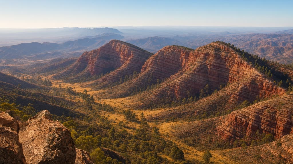
The climb is steady and the track is rough underfoot in places, with loose rock on the upper slopes. Tanderra Saddle opens onto a wide view back over the pound's curved quartzite walls and out across the saltbush plains toward Lake Torrens. The final rise to the 1171 m summit is short, but Adnyamathanha ask walkers to stop at the saddle rather than climb it.
The loop return through the pound floor is flatter and slower under foot, crossing open woodland and creek lines. Carry enough water for the full day, as there is no reliable water on the route.
Safety and conditions
- Check the NPWS SA park page before you leave. The park runs nightly pest-control closures on walking trails, and the St Mary Peak track is closed over summer (December, January and February; the park map lists no access from 6 pm on 30 November to 6 am on 1 March). All walking trails also close on days of Catastrophic Fire Danger.
- Start early. Rangers ask walkers to leave no later than 9 am, or 10 am during daylight saving, so you finish in daylight.
- Carry at least four litres of water per person for a walk of this length, plus food, sun protection and a warm layer. Summer maxima run from 30 to 45 degrees; the most comfortable walking is April to October.
- Sign the Bushwalkers Register at the Wilpena bushwalking trailhead for any walk of three hours or more, and tell a reliable contact your route and expected return.
- Mobile reception is patchy and unreliable, especially in low-lying parts of the pound. Save the park page and a map offline before you go.
- Wear sturdy footwear with grip. The upper slopes are steep and loose in places.
- Dogs are not permitted in the park, except assistance dogs that meet NPWS SA entry requirements.
- Respect the Adnyamathanha request and stop at Tanderra Saddle rather than climbing the summit.
Practical tips
A vehicle entry fee applies: $13.90 per vehicle, paid before entry, or use a SA multi-park pass. The Wilpena Visitor Centre (open 8 am to 5 pm daily) is the place for maps, current track advice and the Bushwalkers Register. Wilpena Pound Resort next door has fuel, a general store, accommodation and a campground; the nearest other supplies are at Hawker, about 60 km south.
Allow a full day. Walk in the cooler months and start at first light in warm weather. The unsealed roads through the park can be rough and change with the weather, so check the outback road report before driving in.
For other long day walks from the same trailhead, the Bridle Gap hike (18.8 km, 6 hrs) follows the Heysen Trail across the floor of Wilpena Pound, and the Malloga Falls hike (23.2 km, 9 hrs) runs out to Edeowie Gorge. Both are for experienced walkers, and Malloga Falls also closes over summer. The Friends of the Heysen Trail maintain the Heysen Trail, which ends in the Flinders Ranges, and run walks and volunteer trips across the range if you want company or local knowledge.
For another hard Australian summit walk, the Bluff Knoll summit walk in Western Australia is a shorter Grade 4 climb, and the Waterfall Gully to Mount Lofty summit walk is the closest South Australian summit to Adelaide. For a remote outback day walk of a similar scale, the Ormiston Pound walk in the West MacDonnell Ranges is a good comparison.