Mt Abrupt (Mud-dadjug) summit walk: Grampians (Gariwerd) National Park guide

Grampians (Gariwerd) National Park, Dunkeld, Victoria, Australia
Published
Last updated
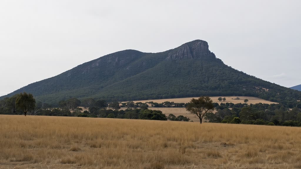
The Mt Abrupt (Mud-dadjug) walk is a steep return climb to one of the higher peaks in the southern Grampians, rising sharply from the volcanic plains about 7 km north of Dunkeld. Parks Victoria lists the track at 6.5 km return and describes it as strenuous; it forms part of the Grampians Peaks Trail and is widely rated Grade 4. The track climbs through heathy woodland and over rock slabs to an 827 m summit with wide views north along the Serra Range and south over the plains toward Dunkeld. It suits walkers with reasonable fitness who are steady on steep, rocky ground and comfortable near unprotected cliff edges, rather than young children or anyone unsure near drops.
Grampians (Gariwerd) National Park is on the traditional Country of the Jadawadjali and Djab Wurrung peoples. The Parks Victoria Mt Abrupt (Mud-dadjug) walk page carries the official track notes and current alerts.
Quick route overview
- Distance: 6.5 km return
- Time: allow about 3 hours return
- Grade: Grade 4
- Route type: return (there and back)
- Summit: 827 m, with about 460 m of climbing
- Terrain: formed track through heathy woodland, then steep climbing over rock slabs and stone steps to an exposed summit ridge
- Start: Mt Abrupt car park, Grampians Road (C216), about 7 km north of Dunkeld
- Access: sealed roads to Dunkeld, then sealed Grampians Road to the car park; conventional 2WD fine
What to expect
The track leaves the car park, crosses Grampians Road and climbs steadily through low heathy woodland. It passes the scars of the 2011 landslides on the lower slopes before steepening onto rock slabs and stone steps. The vegetation thins to stunted montane woodland and heath near the top, with exposed sandstone outcrops along the ridge.
The summit ridge is open and exposed, marked by a steel trig station, with a sheer cliff on the eastern side. On a clear day the view runs north along the Serra Range and south over the Dunkeld plains and the volcanic country beyond. Cloud and wind often sit on the top even when the plains are clear, so the view is never guaranteed.
The same route returns to the car park. The descent is quick but hard on tired knees, and the rock is slippery after rain.
Safety and conditions
- Check the Parks Victoria Mt Abrupt walk page and the weather before you leave. The southern Grampians peaks are subject to rapid weather changes, and the exposed summit ridge is no place to be in strong wind or storms.
- The summit and cliff have unprotected drops. Stay back from edges, keep children close, and do not climb onto rocks for a photo.
- Wear sturdy footwear with grip. Rock slabs and stone steps are slippery when wet.
- Carry drinking water and sun protection. There is no water on the track and no facilities at the car park.
- Mobile reception is unreliable on the summit. Save the park page and a map offline before you go, and tell someone your plan.
- Do not walk on days of high fire danger. Check the Grampians (Gariwerd) National Park page for current closures, road updates and planned burns.
- Dogs and other pets are not permitted in the park, except assistance dogs that meet Parks Victoria's entry requirements.
- Open fires and camping are not permitted on the day walk. The nearby Mud-dadjug hike-in campground is for booked Grampians Peaks Trail walkers only.
Practical tips
There is no park entry fee for Grampians (Gariwerd) National Park. The Mt Abrupt car park is a small unsealed lot on the eastern side of Grampians Road with no toilets, water or shade. The nearest toilets, shops and fuel are at Dunkeld, about 7 km south.
Dunkeld is about a three-hour drive west of Melbourne via the Western Highway to Ballarat and the Glenelg Highway south to Dunkeld, or via Halls Gap and Grampians Road through the centre of the park. Roads to the car park are sealed and suitable for conventional vehicles.
The walk is most comfortable in the cooler months, when the heat and fire risk are lower and the wildflowers are out. Summer days can be hot and the bushfire risk is high, so start early or choose another walk on hot, windy days. Winter brings cold, wet rock and short days. The car park is small and fills on fine weekends and holidays, so arrive early then.
For another southern Grampians summit on the same trackhead, Signal Peak (7.8 km return, Grade 4) shares the Mt Abrupt car park and the lower track before branching off toward its own 780 m summit. The Warrnambool Bushwalkers run regular trips across south-west Victoria if you want company or local knowledge.
For other Australian summit walks on a Grade 4 track, the Mount Oberon summit walk in Wilsons Promontory is another Victorian climb with wide coastal views, and the Bluff Knoll summit walk in Western Australia is a steeper climb to a higher peak.