Bluff Knoll summit walk: Stirling Range National Park guide

Stirling Range National Park, Great Southern, Western Australia, Australia
Published
Last updated
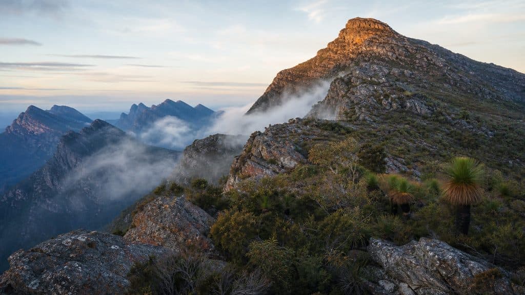
Bluff Knoll is the highest peak in the Stirling Range and the most popular walking track in the range. The summit trail climbs from the Bluff Knoll car park to a 1098 m top with a full 360-degree outlook over the range and, on a clear day, the south coast. Parks and Wildlife Service grades the track 4, and it suits walkers with reasonable fitness who are steady on a long, steep, stepped climb and exposed rock rather than anyone uncomfortable near unprotected cliff edges.
The Stirling Range is the only major mountain range in southern WA, and the park lies within the country of the Goreng and Menang (Noongar) people. The range is known as Koi Kyenunu-ruff, "mist rolling around the mountains", and Bluff Knoll itself, also called Bular Mial, is a place of cultural significance for Minang and Goreng people. The Parks and Wildlife Service Bluff Knoll page and the Stirling Range National Park page carry the official track notes and current alerts.
Quick route overview
- Distance: 6.8 km return
- Time: allow 3 to 4 hours return
- Grade: Grade 4
- Route type: return to the summit
- Summit: 1098 m
- Terrain: formed track, sealed at the start, then a steep stepped climb over rock and gravel to a saddle and an exposed ridge to the top
- Start: Bluff Knoll car park, end of Bluff Knoll Road
- Access: sealed roads; conventional 2WD vehicles fine
What to expect
The track starts on the southern side of the car park and picnic area with a sealed, gentle section before it turns toward the mountain. It follows a creek line directly up the slope, then crosses the mountainside on a steadier climb to a saddle. From the saddle you can look over the ridge toward the south coast, and the trail then turns to follow the ridge up to the summit.
The lower slopes carry eucalypt woodland, banksia and grass trees, while exposed outcrops along the way show the tilted sedimentary layers that record an ancient shallow sea. The climb is a sustained uphill slog with many steps, so the main demand is fitness rather than footing, although the rock is slippery after rain. The summit is a small exposed platform with wide views over the surrounding peaks and, on a clear day, the coast. Cloud and wind often sit on top even when the car park is warm, so the view is never guaranteed.
The same route returns to the car park. The descent is straightforward, but the steps and rock are harder on tired legs and knees, and slippery when wet.
Safety and conditions
- Check the Stirling Range National Park page and the weather before you leave. The Stirling Range peaks are subject to rapid, unpredictable changes, with sudden cool changes that drop the temperature and bring rain or hail even when the day starts warm.
- Carry a warm layer, a rain jacket, sun protection and drinking water. The summit can be windy, cool and clouded while the car park is sunny.
- The summit and ridge have unprotected cliff edges. Stay back from edges, keep children close, and do not climb onto rocks for a photo.
- Wear sturdy footwear with grip. Steps and rock are slippery when wet.
- Parks and Wildlife Service recommends carrying a personal locator beacon (PLB) in this remote area, and filing a trip intentions form with a reliable contact who can raise the alarm if you do not return on time.
- Do not walk on days of extreme fire danger. Mobile reception is unreliable on the summit, so save the park page and a map offline before you go.
- Dogs and other pets are not permitted in the park. The area is baited with 1080 poison under the Western Shield program, which is lethal to dogs and cats.
- Open campfires are not permitted anywhere in the park.
Practical tips
A vehicle entry fee applies to Stirling Range National Park. The standard fee is $17 per vehicle ($10 concession) for a day entry, paid at the Stirling Range Entry Station on Bluff Knoll Road or with a valid Western Australian park pass. Entry is free if you walk or cycle in. See the Explore Parks WA entry fees page for current rates and pass options.
Bluff Knoll is about 4.5 hours south of Perth and 1.5 hours from Albany via Chester Pass Road. The road into the car park is sealed and suitable for conventional vehicles. The car park has toilets, picnic tables, a shade shelter and three wheelchair-accessible viewing decks, so the lookouts are worth a stop even if you are not climbing. There is no drinking water at the trailhead.
The walk is most comfortable in late autumn and spring, when the heat is lower and the wildflowers are out. Summer days can be hot and the bushfire risk is high from December to April, so start early or choose another walk on hot, windy days. Winter nights are cold and storms are common from May to October.
Camping inside the park is at the bookable Moingup Spring Campground, which has flush toilets, a shelter with a gas stove and barbecue, and no campfires. Book ahead online. The privately run Stirling Range Retreat and Mount Trio Bush Camping and Caravan Park sit on the northern boundary of the park if you prefer powered sites or cabins.
For other Stirling Range summits on established tracks, Mount Hassell (3 km return, Grade 4) and Mount Trio (3.5 km return, Grade 4) are shorter climbs from nearby car parks, while Toolbrunup Peak (4 km return, Grade 4) is a rougher scramble to the second-highest point in the range. The Albany Bushwalkers run regular walks on the south coast and in the Stirling Range if you want company or local knowledge.
For other Australian summit walks on a similar Grade 4 track, the Mount Oberon summit walk in Wilsons Promontory and the Mount Coolum summit walk on the Sunshine Coast are both shorter coastal climbs with wide views, and the Mount Bartle Frere summit walk in Far North Queensland is a longer, wetter rainforest alternative.