Mount Bartle Frere summit walk: Wooroonooran National Park guide

Wooroonooran National Park, Far North Queensland, Australia
Published
Last updated
Mount Bartle Frere is the highest point in Queensland at 1622 m, rising out of the Bellenden Ker Range in Wooroonooran National Park. The eastern summit walk climbs from Josephine Falls through thick Wet Tropics rainforest to a cloud-bound granite summit. It is a serious mountain day rather than a casual waterfall stop, and QPWS warns that only experienced and very fit bushwalkers should attempt it.
The 15 km return route gains about 1500 m and is graded 5. Most walkers spread it over two days using the walk-in campsites; a single-day push takes 10 to 12 hours and leaves little margin for weather or injury. The same trail can also be walked as a through-hike to the Atherton Tableland on the western side.
Wooroonooran National Park is on the country of the Noongyanbudda Ngadjon people. The QPWS Bartle Frere trail page carries the park welcome, current alerts and the official journey notes.
Quick route overview
- Distance: 15 km return (Josephine Falls to summit and back)
- Time: 10 to 12 hours as a day walk; allow 2 days with an overnight camp
- Grade: Grade 5
- Route type: return from Josephine Falls, or a through-hike to the western (Atherton Tableland) trailhead
- Elevation: about 1500 m of climb, from roughly 100 m to the 1622 m summit
- Terrain: formed but rough rainforest track, root ladders, creek crossings, steep scrambles and a slippery boulder field near the top
- Start: Josephine Falls car park, Wooroonooran National Park
- Access: sealed road off the Bruce Highway; conventional vehicles fine in dry conditions
What to expect
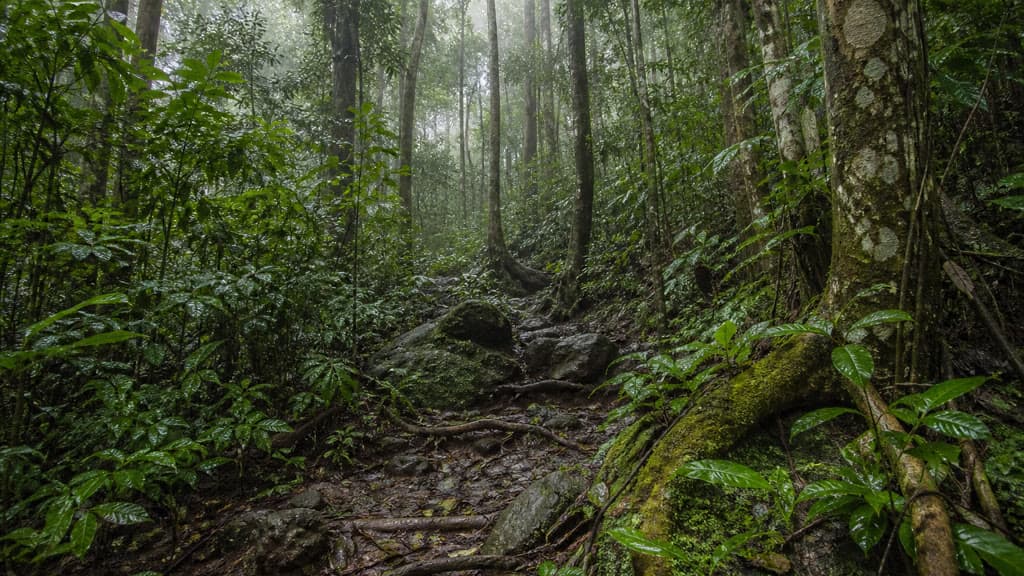
The track leaves the Josephine Falls car park and climbs through tall tropical rainforest. The first section is relatively open and takes about an hour to reach Majuba Creek, a useful spot to top up water before the climb steepens. Beyond the creek the track narrows over rocks and gnarled root systems and follows a ridge towards Big Rock camping area, 3 km from the start.
The hardest climbing comes above Big Rock. The route scrambles through boulder fields and over root ladders, and the vegetation thins to lower, scrubby cloud forest as you gain height. Eastern Summit camping area sits at about 7 km, roughly an hour below the top. Above it, granite slabs open out and the summit is a final steep push over a boulder field that becomes treacherous when wet.
Do not bank on a view. The summit spends much of its time inside cloud, and clear weather is the exception rather than the rule. From the top you can return the way you came, or continue west down to the Atherton Tableland trailhead if you have arranged transport.
Safety and conditions
- Read the QPWS Bartle Frere trail page and any current park alerts before committing. The eastern approach has faced periodic track maintenance closures, so confirm the route is open on the day you plan to walk.
- This is a remote, high-rainfall mountain. More than 8 m of rain falls on the summits each year, and over 1100 mm has been recorded in 24 hours. Expect heavy rain, low cloud, cold temperatures and sudden changes even on a fine morning at the car park.
- Creek crossings can rise quickly. Do not cross flooded or fast-flowing water, and turn back if conditions deteriorate.
- The upper boulder field requires scrambling and is dangerously slippery when wet. Slow down, keep three points of contact, and retreat if the rock is not safe.
- Carry a topographic map and compass and do not rely on a phone for navigation. Mobile reception is unreliable and disappears for much of the climb.
- Leave your route and expected return time with a responsible person. A personal locator beacon is a sensible backup for a walk of this length and isolation.
- Carry all the drinking water you need. There is a small creek near Western Summit campsite but no guaranteed water along the trail, and any water collected must be treated.
- Leeches are common in the damp forest. Cassowaries live in this park - keep your distance, never feed them, and back away calmly if you meet one. See stinging trees, snakes and habitats in North Queensland for ground-level wildlife awareness.
- Dogs and other domestic animals are not permitted in Wooroonooran National Park. Fires are not allowed anywhere on the trail - use a fuel stove.
Practical tips
Josephine Falls is about 75 km south of Cairns. Turn off the Bruce Highway 2 km south of Miriwinni and drive 8 km to the car park. The access road is sealed and suitable for conventional vehicles, but check it after heavy rain. Babinda, Innisfail and Cairns are the nearest towns for fuel, food and supplies.
Camping on the trail requires a permit booked in advance through the QPWS Bartle Frere trail camping page; self-registration at the campsites is not possible. There are four walk-in camping areas - Junction (western, vehicle access), Western Summit, Eastern Summit and Big Rock. Each is limited to eight people a night with a maximum group size of four, and none have facilities. An emergency evacuation hut at Eastern Summit is for emergencies only and should not be counted on for shelter.
If you are not ready for a Grade 5 summit day, the short Josephine Falls walk to the viewing platforms is a separate, easy rainforest stroll from the same car park, and the Wooroonooran and Misty Mountains day walks guide sets out the broader area. For wet-season planning across the tropics, see wet season waterfall hiking in the tropics. The Cairns bushwalking club is a local option if you want company or advice before attempting a mountain of this scale.