The Ultimate Guide to Hiking Magnetic Island: Best Tracks and Lookouts

Published
Last updated
Magnetic Island (Yunbenun) is North Queensland's most approachable "big walk" destination: ferries from Townsville, national park headlands, snorkel bays, and ridge tracks that switch from tourist-friendly to genuinely strenuous within a few kilometres. This guide is written for walkers and hikers planning Magnetic Island walks-not for ticking every lookout in one overheated afternoon.
Treat Magnetic Island as several microclimates stitched by ferry and ridge-not one homogeneous stroll.
Start every trip with QPWS park alerts and the official journey pages listed below. Tracks close after cyclones or severe weather; creek lines change character after rain.
Official references
Bookmark maps offline-signal disappears politely exactly when selfies refuse uploads mid-descent.
- Walking trails summary - Magnetic Island National Park
- Forts Walk
- Nelly-Arcadia-Junction track
- Maps and resources
Ferry-first logistics (non-negotiable)
Treat the sea crossing as part of the hike:
- Know last ferries before you commit to a long loop-storms and wildlife stops burn time faster than maps suggest.
- Carry cash/card assumptions you verify with the operator you actually use-services and terminals change; screenshots beat optimism.
- Island buses connect bays when legs are tired-plan transfers instead of heroic road walks in heat.
If you cannot finish comfortably before your safe ferry window, shorten the route. Rescue timelines on islands are never instant.
Parking, terminals, and "five more minutes"
Mainland parking behaviour carries emotional baggage-arguing curbside while the gang waits invites rushed stair descents later. Arrive early enough to walk calmly to the boat; adrenaline belongs on optional scrambles, not on boarding ramps.
On-island, note which bay your accommodation hugs-cross-island returns during heat-of-day feel longer than map kilometres imply when humidity stacks.
Hydration maths (brief)
Two litres sounds heroic until hour three when sweat salts crystallise on shirt seams unnoticed. Electrolytes matter on big sweat days-trial them at home before betting holidays on untested gut reactions.
Forts Walk - popular for good reasons
The Forts Walk is the island's signature Grade 3 journey: World War II heritage, koala sightings possible (never guaranteed), and wide views across Pallarenda and the mainland. QPWS describes rough, steep surfaces in places-expect decomposed granite, uneven stairs, and overtaking etiquette on narrow tread.
Why it feels "tourist-heavy": accessibility from Arcadia/Nelly Bay combinations, koala fame, and heritage signage pull steady traffic. Early starts reduce crowding and heat load.
Hiker mindset: pause for downhill friction-granite laughs at rushed trainers.
Interpretive panels reward readers who slow down-heritage context lands better when pulse rates stay conversational. If groups bottleneck at pinch points, treat waits as shade breaks rather than morale collapses-North Queensland ridges punish rushed overtakes more than polite patience ever did.
Choosing your island "lane": tourists vs club-grade walking
Magnetic Island hiking trails range from short paved links near ferry terminals to thigh-burning climbs where sweat diplomacy matters more than pace records. There is no shame in picking tourist-heavy routes when views reward families fairly-save Junction-country ambitions for days when sleep, food, and hydration align.
Experienced North Queensland walkers sometimes stitch off-track travel only where legally permitted, culturally respectful, and within club-grade navigation-this article stays focused on QPWS-listed journeys because unauthorised shortcuts inherit trespass and rescue ambiguity.
Contrasting routes - harder country and fewer crowds
Nelly-Arcadia-Junction track (Grade 4 segments)
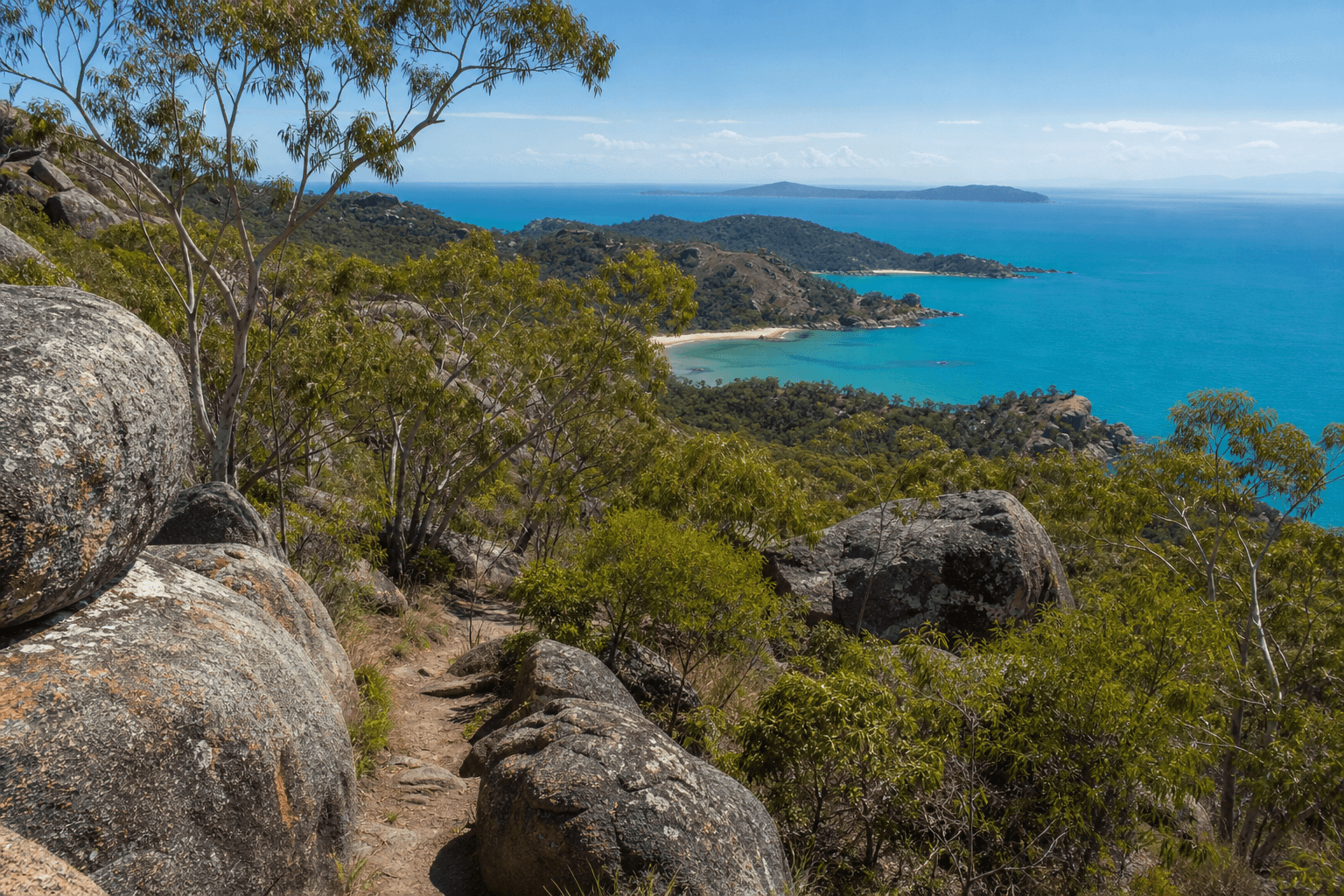
The Nelly-Arcadia-Junction journey links steep highland sections between bays. QPWS lists it as Grade 4 in places-natural stone steps, demanding climbs, and slower kilometres than Forts psychologically prepares tourists for. Sphinx Lookout sits on this network: views toward Alma Bay and across to Cape Cleveland-atmospheric when mist clears.
Use this track when you want quiet(er) ridge time and accept sweat equity. Not every visitor belongs here-turn around where signage or your gut says stop.
Endeavour Falls (Arcadia) - seasonal waterfall walking
Locals and visitors often pair Arcadia's Endeavour Falls walk when creeks run after rain. Flow varies wildly by season; slippery rocks and unseen depths turn photogenic pools into ankle traps. Check conditions locally, respect private boundaries where relevant, and treat unofficial beta as unverified-your crossing judgement matters more than a screenshot. If in doubt, enjoy the lower pools from stable ground and call it a win.
Swim stops vs hike days
Horseshoe, Florence, and Arcadia each offer different snorkel and shade logic. Combining a hard Grade 4 morning with an afternoon swim sounds ideal until dehydration deceives you-fuel before ridges, hydrate before euphoria.
Sample weekend (adjust to forecasts)
Day 1 - visibility and heritage
- Early Forts Walk while granite stays cooler underfoot.
- Late swim at a bay matching your lodging-minimise cross-island bus ping-pong.
Day 2 - effort day
- Nelly-Arcadia-Junction segment sized to your fitness truth-not influencer stamina.
- Afternoon shallow snorkel or shaded café recovery instead of fake "second summit."
If lightning forecasts interrupt ridges, pivot to esplanade-style bay walks and wildlife patience instead of ridge FOMO.
Track surfaces walkers underestimate
Decomposed granite rolls under shoes until it doesn't-micro-slides accumulate on tired calves. Natural stone steps reward patience: shorten stride, plant feet fully, use poles if knees complain. Humid coastal air obscures sweat loss-sip before thirst cues arrive.
Rock-hopping near splashing creeks tempts bold leaps-choose stable wedged stones, test weight gradually, keep hands free for balance instead of cameras until footing locks.
If in doubt, sit, breathe, and watch how locals pick lines-mimic patience before mimicking bravado.
Contrasting Forts with Junction - honest expectations
| Factor | Forts Walk (typical Grade 3 focus) | Nelly-Arcadia-Junction network |
|---|---|---|
| Crowding | Higher near koala-famous segments | Often quieter kilometre-for-kilometre |
| Heritage | WWII structures + signage | Mixed rainforest/grassland transitions |
| Fitness ask | Moderate with spikes | Sustained steep sections |
| Wildlife luck | Koalas possible | Koalas possible-never chase |
Numbers vary by humidity-ignore stopwatch bragging.
Stinger season and coastal realism
Marine stingers can affect where and how you finish a hike that "promises" a swim. Read Surf Life Saving Queensland, Queensland Health, and local signage for your travel window. Stinger suits where recommended; never assume calm water equals safe water.
Heat exhaustion pairs badly with sting risk-people make worse swim decisions when dizzy.
Skip heroic ocean entries when overheated-even paradise bays punish fuzzy cognition-rest first.
Wildlife etiquette (short, serious)
- Koalas: observe quietly from distance; climbing or noise-stressing animals is unsafe and unethical.
- Snakes: freeze, back off, reroute-troppo bravado ages poorly on narrow tracks.
- Cassowaries: rare encounters deserve distance and calm-QPWS guidance over selfies.
When "club culture" changes your island day
Members of The Townsville Bushwalking Club and similar groups often carry group first-aid norms, pace agreements, and turn-back discipline learned on North Queensland stone. You do not need a club card to enjoy Magnetic Island- but reading their public trip reports illustrates how experienced locals stack water, time, and ferry buffers when humidity spikes.
Photography and other visitors
Busy lookouts need queue patience-step aside for faster descents, yield on narrow pins, and keep voices low near wildlife. A polite island walking culture costs nothing and prevents avoidable edge-case accidents when tired strangers meet on polished granite.
Night walking reality
Most visitors should not extend Forts or Junction into darkness without intentional night-hiking skills-missing last ferries after ankle tweaks ruins more holidays than missing sunset gram pixels.
Pairing with mainland Townsville hubs
If Magnetic Island is only half your North Queensland hiking plan, bookmark:
For organised trip culture and route discipline common on harder North Queensland days, see trip-report patterns from The Townsville Bushwalking Club. For longer narrative routes beyond pure logistics, Wanderstories sometimes complements-but never replaces-QPWS facts.
Planning checklist
- Park alerts + journey PDF saved offline
- Water + electrolytes sized for humidity, not Melbourne assumptions
- Sun gear + minor first aid + whistle
- Ferry timetable screenshot
- Stinger plan if swimming
Pack duplicates worth carrying
A spare lightweight shirt after salty climbs improves downstream comfort; damp synthetic layers chafe less dramatically than cotton pretending optimism. Backup batteries for headlamps matter less than backup patience when lightning delays ferries-carry calm proportionate to humidity.
FAQ
Best month for comfortable hiking?
Dry-season mornings typically behave milder; wet-season greens stunning creek lines but raises slipping and closure risk.
Forts or Junction first?
If unsure on fitness, Forts first on day one; attempt Junction when legs still honest.
Can beginners do Magnetic Island "properly"?
Yes-choose Grade 2-3 journeys and short swim recovery; skip Grade 4 fantasy until conditioning matches.
Do I need navigation tools?
Formed tracks still benefit from offline maps-ridges eat phone reception.
What about Endeavour Falls after drought?
Sometimes a rocky scramble to disappointment-manage expectations; waterfalls owe nobody aesthetics on demand.
Are drones OK?
Check CASA rules and local bans-national parks and wildlife stress rarely justify noisy props.
Should kids ride Junction?
Only if pace and turnaround rules are explicit-heat crankiness escalates faster than elevation profiles imply.